We create until the 17th of August 240 Hiking Trails around Samosir. Already we started with some.
Hiking Paradise Samosir
Samosir can be a Class A World Destination for Hiking:
-
- It is the biggest island in a Volcano of the biggest Caldera of the world.
- It is nominated for an UNESCO Geopark
- There are a lot of old hiking trials used from the Aborigines since some hundred years.
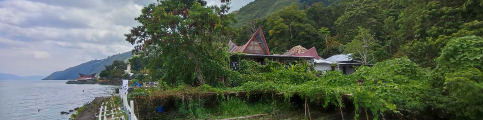
- All the Island is surrounded by the wonderful Lake Toba
- The Lake is 1000 m above the sea level and the highs of Samosir going up to 1700 m.
- On top of Samosir is a plateau where you have a wonderful panorama
- You can visit all the small Batak villages, everywhere you can stay and eat and sleep.
- In the Evening the Batak people like to make music and are happy, if they have guests.
- the climate is the hole year around 25 – 30 degrees
- if there is rain, then in 95 % lasts not longer than 2 hours
- mostly it is cloudy and with this it is nice to hiking
Here we will publish all the hiking trails. Just follow the links:
At the 17th of August, the National Day of Indonesia, we have the planning, that each of the 239 schools in Samosir make one hiking trail.
What is getting done at this day:
- Cleaning the Hiking trail
- Sign it. We already developed a sign for the first Hiking Trail:
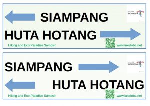
A draft for signs of Hiking Trails - Make nice photos from the whole trek and upload this directly to google maps. Each student can do this. Just activate google photos, and let record your position. Than you click in google maps just on the button contribute and directly you can upload the photos with the correct geo position.
- All routes are recorded. From Each school one student download the app from Google Play: Caynax sports tracker. Here you record the route. This can be then exported. The exported file is then getting send to maps@laketoba.net.
- All the routes are getting added to a google map, which then directly can be published and everybody on the world can use the map with the 240 hiking trails
- We make a photo and a Video Documentary about this and will publish this.
- In the preparation we inform all the media around the globe from our activity to create a Hiking Paradise in one day. The German alpinistic organization with more then 1.3 Million members already five years ago where interested in an article about this operation. Always they look for new destinations.
- Also at the way of the hiking trail can come up restaurants and homestays. We help also for this to make it. Also we prepare already a standard menu for the trecking people. This also will be published in google and on the google maps with the contact to the owner. And also photos will be done there.
Here is the old draft of this Presentation Ecowisata